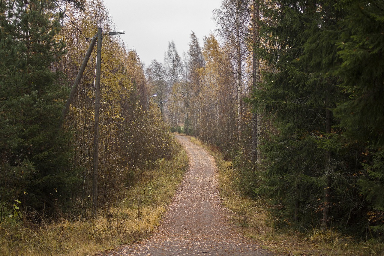
Parks and Wilderness Areas Near the Boundary Waters

Exploring the Northwoods

The region surrounding the Boundary Waters Canoe Area Wilderness offers some of the most remarkable protected landscapes in North America. From national parks rich in natural and cultural history to remote provincial parks and historic trade routes, this area showcases diverse ecosystems, ancient geology, and a deep connection between people and the land. Below is an overview of nearby parks and wilderness areas that highlight the broader environmental and historical context of the Boundary Waters region.

Voyageurs National Park

Voyageurs National Park

Established on April 8, 1975, Voyageurs National Park showcases ancient bedrock shaped by glaciers and covered by a thriving boreal forest. The landscape includes rugged hills, beaver ponds, bogs, islands, and four large lakes. Located along Minnesota’s northern border, about 15 miles from International Falls, the park stretches 55 miles alongside Ontario, Canada.

Importantly, Voyageurs is a water-based park, with most areas accessible only by boat. Public boat ramps and parking are available near visitor centers and nearby campgrounds. The park’s continental climate brings warm summers and cold winters, allowing year-round outdoor activities, from boating and fishing to skiing and snowmobiling.

Superior National Forest

Superior National Forest

Spanning over three million acres along Minnesota’s border with Canada, Superior National Forest was established in 1909. The area includes part of the Boundary Waters Canoe Area Wilderness and contains over 445,000 acres of lakes, along with more than 2,000 miles of rivers and streams. This northern forest is home to a variety of wildlife, including moose, black bears, and one of the largest populations of gray wolves in the contiguous United States.

Visitors enjoy a wide range of seasonal activities, including canoeing, hiking, fishing, and swimming in summer; skiing, snowmobiling, and ice fishing in winter. Moreover, the land’s rugged terrain and glacial history have shaped its many lakes and rocky outcrops. Over 11,000 years, soil and vegetation have slowly reclaimed the area.

Humans have lived here for over 10,000 years. The region’s fur trade history remains evident in routes once traveled by French-Canadian voyageurs. Today, forest management focuses on balancing recreation, resource use, and long-term conservation.

Isle Royale National Park

Isle Royale National Park

Located in Lake Superior, Isle Royale is a remote wilderness archipelago covering 850 square miles. Authorized in 1931 and established in 1940, it received wilderness designation in 1976 and became a U.S. Biosphere Reserve in 1980. The island’s landscape was formed by ancient lava flows and glaciers, creating a rugged terrain ideal for hiking, paddling, and wildlife observation.

Access is limited to boat or floatplane, and weather conditions can be unpredictable. The park remains open from mid-April through October, with transportation services varying by season. Additionally, visitors can explore historic lighthouses, shipwrecks, and copper mining sites while encountering moose, wolves, and pristine wilderness.

La Verendrye Provincial Park

La Verendrye Provincial Park

Directly north of the Boundary Waters, La Verendrye Provincial Park in Ontario preserves a scenic waterway once used by fur traders. Known for its quiet beauty, the park features steep mesas and rare plant species. While there are no developed facilities, camping and paddling are permitted. This park highlights the historic water routes that connect to the region’s larger network of canoe trails.

Grand Portage National Monument

Grand Portage National Monument

Located in northeastern Minnesota, Grand Portage National Monument preserves a key site in North American fur trade history. Designated a national monument in 1960, it includes reconstructed trade-era buildings and the historic Grand Portage trail. This 8.5-mile footpath once linked Lake Superior to inland rivers and trade routes used by voyageurs and Native peoples.

Today, the site remains culturally important to the Grand Portage Band of Lake Superior Chippewa. Visitors can explore the monument year-round. In summer, reconstructed buildings are open to the public, while in winter, the trail offers opportunities for snowshoeing and skiing.

Apostle Islands National Lakeshore

Apostle Islands National Lakeshore

Extending into Lake Superior, the Apostle Islands National Lakeshore includes 21 islands and 12 miles of mainland shoreline. Designated in 1970, it features sea caves, historic lighthouses, and remnants of old-growth forest. The area’s natural beauty is complemented by stories of its past, former quarries, homesteads, and shipwrecks lie scattered across the landscape.

Recreation opportunities include kayaking, hiking, and wildlife viewing. Although summers bring mild temperatures, conditions on the lake can change rapidly. Therefore, visitors should prepare for sudden storms or cold water temperatures. The lakeshore remains open year-round.

Preserving a Shared Wilderness Heritage

Together, these parks and wilderness areas form a vast, interconnected landscape of forests, lakes, and waterways. They reflect both the geological forces that shaped the Northwoods and the human histories that have played out across them. While each area has its character, all contribute to a shared legacy of conservation, stewardship, and public access to the wild.

Boundary Waters Canoe Area Wilderness Act of 1978 (Public Law 95-495 92 Stat. 1649)

Summary

The Boundary Waters Canoe Area Wilderness Act of 1978 was a landmark piece of environmental legislation aimed at protecting one of the most pristine and heavily visited wilderness areas in the United States. Located in northeastern Minnesota, the Boundary Waters Canoe Area (BWCA) encompasses over a million acres of forests, lakes, and streams along the U.S.-Canada border. This act reinforced wilderness protections, clarified usage rules, and set a framework for managing both environmental conservation and recreational access.

Wilderness Designation and Boundaries

The act formally designated the BWCA as part of the National Wilderness Preservation System under the Wilderness Act of 1964. This gave it the highest level of federal protection. It prohibited commercial activities such as logging and mining, ensuring the area would remain undeveloped and preserved for future generations.

The legislation also defined a separate “mining protection area” adjacent to the wilderness. This area was protected from future mineral development and resource extraction to prevent environmental degradation near the BWCA’s borders.

Motor Use and Access Rules

To protect the natural quiet and wilderness character of the BWCA, the act imposed specific limitations on motorboats, snowmobiles, and aircraft landings. However, it allowed continued use of motors on certain lakes where traditional access had long been permitted. Some lakes were placed under temporary motor use until later reviews.

Floatplane landings were banned, and existing motorized portages were reduced. These regulations aimed to reduce environmental impacts while accommodating some long-standing visitor access.

Logging and Timber Harvesting Ban

Commercial logging was permanently banned within the BWCA. Previously, timber harvests had occurred in parts of the area under earlier management plans. The act ended this practice, prioritizing ecological preservation over resource extraction. Logging was also prohibited in the mining protection area to maintain the buffer zone around the wilderness.

Cooperative Management and State Jurisdiction

Although federally managed by the U.S. Forest Service, the act emphasized cooperation with the State of Minnesota. It preserved the state’s jurisdiction over fish, wildlife, and water regulation within the BWCA and nearby lands. Federal regulations could be enforced jointly with state authorities, and state law could still apply in non-federal zones inside the protected area.

The act also clarified that existing treaties and civil or criminal jurisdiction of the state were not to be affected by this legislation.

Infrastructure and Dam Maintenance

The law permitted continued maintenance of the Prairie Portage Dam, which controls water levels between Birch and Basswood Lakes on the international boundary. Other water control structures could also be maintained if necessary for public safety or wilderness values.

Recreation Outside the Wilderness

Recognizing that the new restrictions could limit certain types of recreation, the act directed the Forest Service to expand recreational opportunities outside the wilderness. This included building new snowmobile trails, remote campsites, lake access points, and parking areas to support motorized and traditional outdoor use.

A system of hiking, backpacking, and cross-country ski trails was also authorized—both inside and outside the BWCA—providing new low-impact recreational options.

Support for Local Communities and Businesses

The act acknowledged the economic impact of new restrictions on resorts, outfitters, and tourism-related businesses. It authorized technical and financial assistance programs to help these businesses adapt to the changes. The University of Minnesota’s Agricultural Extension was also funded to provide training and support for economic development aligned with wilderness values.

Education and Accessibility Programs

A key provision required the Forest Service to create educational programs for BWCA users. These would help visitors understand the purpose of wilderness preservation and how to responsibly enjoy the area. The law also directed the development of outdoor programs for people with disabilities, expanding access to wilderness experiences for all.

Management Planning and Funding

The act mandated a comprehensive management plan for the BWCA to be completed by 1981. The plan would detail how to balance conservation goals with recreation, enforcement, and public involvement.

Importantly, the act delayed funding authorizations until October 1, 1979, ensuring time to develop the required frameworks. No funds or agreements could proceed without Congressional appropriations.


Legacy of the Act

The Boundary Waters Canoe Area Wilderness Act of 1978 stands as one of the most significant legal protections ever granted to a U.S. wilderness area. It resolved longstanding debates over logging, mining, motorized access, and recreation in the region. The law preserved the area’s wild character while allowing for regulated access, cooperation with the State of Minnesota, and support for nearby communities.

The Boundary Waters Canoe Area Wilderness has since served as a model for wilderness stewardship, offering solitude, scenic beauty, and immersive natural experiences made possible through the protections established in this act.

Wilderness Act of 1964

Understanding the Purpose

A Legacy of Preserving America’s Wild Places

In 1964, a historic step was taken to protect America’s natural landscapes. The Wilderness Act, signed into law on September 3 of that year, didn’t just set aside land—it created a bold vision for conserving the nation’s last untouched areas.

At its core, the Wilderness Act established the National Wilderness Preservation System. This system gave formal protection to over 9 million acres of federal land, with the goal of preserving these places “where the earth and its community of life are untrammeled by man.” It’s a law rooted in the idea that some parts of nature should remain wild, untouched by development, roads, or industry.

What Does the Act Do?

The Act outlines a detailed framework for how wilderness areas are designated, managed, and protected:

  • Designation of Wilderness Areas
    Lands in national forests, parks, and wildlife refuges can be officially declared wilderness areas by Congress. Once designated, these areas are protected from permanent roads, commercial enterprises, and structures. Mechanical transport and motorized equipment are generally prohibited, preserving the area’s primitive condition.
  • Management and Responsibility
    The Secretary of Agriculture and the Secretary of the Interior oversee wilderness areas, each within their department’s jurisdiction. They are responsible for developing rules that uphold the law’s intent and ensure these lands remain as wild as possible.
  • Special Provisions and Exceptions
    Though preservation is the goal, the Act allows certain uses when necessary. These include:
    • Continued use of aircraft or motorboats in areas where such use was established before the Act.
    • Control of fires, insects, and diseases if required.
    • Limited mineral exploration and surveys (allowed until the end of 1983), as long as they align with wilderness values.
    • Water and power projects, and livestock grazing, under strict regulation.
    • Commercial services when essential to recreational or educational purposes.

Navigating Ownership and Access

The Act recognizes the complex mosaic of land ownership. In cases where private or state lands are surrounded by wilderness, access rights are granted, or land exchanges are encouraged. Valid mining claims and other rights are also respected, though strictly regulated to protect the wilderness character.

Supporting Wilderness with Donations and Gifts

The Act also encourages public support. The Secretary of Agriculture can accept gifts or bequests of land, either within or next to wilderness areas, to expand protections. Private donations to support the Act’s goals are also permitted.

Oversight and Reporting

The Wilderness Act directs the Secretaries of Agriculture and the Interior to provide regular reports to Congress on the status of the National Wilderness Preservation System. These reports help inform lawmakers about ongoing conditions at that time, management efforts, and future needs related to wilderness protection.


This law was more than just an environmental measure, it was a statement of values. The Wilderness Act remains one of the most influential conservation laws in U.S. history, inspiring generations to appreciate and defend the untamed beauty of America’s natural heritage.